| Lesotho | 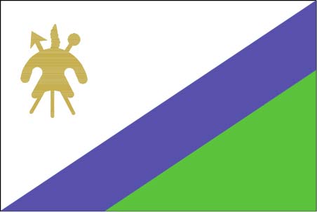 |
|
|
Introduction
Geography
People
Government
Economy
Communications
Transportation
Military
Transnational Issues Print This Frame Airports Hotels
|
||
 |
||
| Lesotho | Introduction | Top of Page |
| Background: | Basutoland was renamed the Kingdom of Lesotho upon independence from the UK in 1966. Constitutional government was restored in 1993 after 23 years of military rule. |
| Lesotho | Geography | Top of Page |
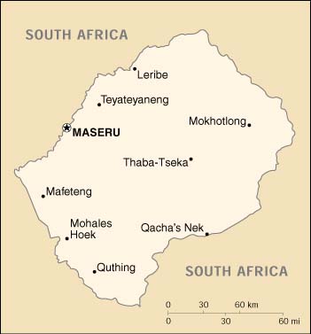
| Location: | Southern Africa, an enclave of South Africa |
| Geographic coordinates: | 29 30 S, 28 30 E |
| Map references: | Africa |
| Area: |
total:
30,355 sq km
land: 30,355 sq km water: 0 sq km |
| Area - comparative: | slightly smaller than Maryland |
| Land boundaries: |
total:
909 km
border countries: South Africa 909 km |
| Coastline: | 0 km (landlocked) |
| Maritime claims: | none (landlocked) |
| Climate: | temperate; cool to cold, dry winters; hot, wet summers |
| Terrain: | mostly highland with plateaus, hills, and mountains |
| Elevation extremes: |
lowest point:
junction of the Orange and Makhaleng Rivers 1,400 m
highest point: Thabana Ntlenyana 3,482 m |
| Natural resources: | water, agricultural and grazing land, some diamonds and other minerals |
| Land use: |
arable land:
11%
permanent crops: 0% permanent pastures: 66% forests and woodland: 0% other: 23% (1993 est.) |
| Irrigated land: | 30 sq km (1993 est.) |
| Natural hazards: | periodic droughts |
| Environment - current issues: | population pressure forcing settlement in marginal areas results in overgrazing, severe soil erosion, and soil exhaustion; desertification; Highlands Water Project controls, stores, and redirects water to South Africa |
| Environment - international agreements: |
party to:
Biodiversity, Climate Change, Climate Change-Kyoto Protocol, Desertification, Hazardous Wastes, Marine Life Conservation, Ozone Layer Protection
signed, but not ratified: Endangered Species, Law of the Sea, Marine Dumping |
| Geography - note: | landlocked, completely surrounded by South Africa; mountainous, more than 80% of the country is 1,800 meters above sea level |
| Lesotho | People | Top of Page |
| Population: |
2,177,062
note: estimates for this country explicitly take into account the effects of excess mortality due to AIDS; this can result in lower life expectancy, higher infant mortality and death rates, lower population and growth rates, and changes in the distribution of population by age and sex than would otherwise be expected (July 2001 est.) |
| Age structure: |
0-14 years:
39.28% (male 430,147; female 424,994)
15-64 years: 56.03% (male 588,440; female 631,404) 65 years and over: 4.69% (male 43,033; female 59,044) (2001 est.) |
| Population growth rate: | 1.49% (2001 est.) |
| Birth rate: | 31.24 births/1,000 population (2001 est.) |
| Death rate: | 15.7 deaths/1,000 population (2001 est.) |
| Net migration rate: | -0.63 migrant(s)/1,000 population (2001 est.) |
| Sex ratio: |
at birth:
1.03 male(s)/female
under 15 years: 1.01 male(s)/female 15-64 years: 0.93 male(s)/female 65 years and over: 0.73 male(s)/female total population: 0.95 male(s)/female (2001 est.) |
| Infant mortality rate: | 82.77 deaths/1,000 live births (2001 est.) |
| Life expectancy at birth: |
total population:
48.84 years
male: 47.97 years female: 49.74 years (2001 est.) |
| Total fertility rate: | 4.08 children born/woman (2001 est.) |
| HIV/AIDS - adult prevalence rate: | 23.57% (1999 est.) |
| HIV/AIDS - people living with HIV/AIDS: | 240,000 (1999 est.) |
| HIV/AIDS - deaths: | 16,000 (1999 est.) |
| Nationality: |
noun:
Mosotho (singular), Basotho (plural)
adjective: Basotho |
| Ethnic groups: | Sotho 99.7%, Europeans, Asians, and other 0.3%, |
| Religions: | Christian 80%, indigenous beliefs 20% |
| Languages: | Sesotho (southern Sotho), English (official), Zulu, Xhosa |
| Literacy: |
definition:
age 15 and over can read and write
total population: 83% male: 72% female: 93% (1999 est.) |
| Lesotho | Government | Top of Page |
| Country name: |
conventional long form:
Kingdom of Lesotho
conventional short form: Lesotho former: Basutoland |
| Government type: | parliamentary constitutional monarchy |
| Capital: | Maseru |
| Administrative divisions: | 10 districts; Berea, Butha-Buthe, Leribe, Mafeteng, Maseru, Mohales Hoek, Mokhotlong, Qacha's Nek, Quthing, Thaba-Tseka |
| Independence: | 4 October 1966 (from UK) |
| National holiday: | Independence Day, 4 October (1966) |
| Constitution: | 2 April 1993 |
| Legal system: | based on English common law and Roman-Dutch law; judicial review of legislative acts in High Court and Court of Appeal; has not accepted compulsory ICJ jurisdiction |
| Suffrage: | 18 years of age; universal |
| Executive branch: |
chief of state:
King LETSIE III (since 7 February 1996); note - King LETSIE III formerly occupied the throne from November 1990 to February 1995, while his father was in exile
head of government: Prime Minister Pakalitha MOSISILI (since 23 May 1998) cabinet: Cabinet elections: none; according to the constitution, the leader of the majority party in the assembly automatically becomes prime minister; the monarch is hereditary, but, under the terms of the constitution which came into effect after the March 1993 election, the monarch is a "living symbol of national unity" with no executive or legislative powers; under traditional law the college of chiefs has the power to determine who is next in the line of succession, who shall serve as regent in the event that the successor is not of mature age, and may even depose the monarch |
| Legislative branch: |
bicameral Parliament consists of the Senate (33 members - 22 principal chiefs and 11 other members appointed by the ruling party) and the Assembly (80 seats; members elected by popular vote for five-year terms); note - number of seats in the Assembly rose from 65 to 80 in the May 1998 election; on 28 February 2001, the Senate approved expansion of the Assembly by a further 50 seats in the next election, which may be held as early as January 2002
elections: last held 23 May 1998 (next to be held NA March 2001) election results: percent of vote by party - LCD 60.7%, BNP 24.5%, other 14.8%; seats by party - LCD 79, BNP 1 note: results contested; opposition parties claimed the election was fraudulent and staged a coup; Southern African Development Community (SADC) forces intervened in September 1998 and restored order; the Interim Political Authority (IPA) was set up in December 1998 to create a new electoral system and conduct new elections. |
| Judicial branch: | High Court (chief justice appointed by the monarch); Court of Appeal; Magistrate's Court; customary or traditional court |
| Political parties and leaders: | Basotho Congress Party or BCP [Tseliso MAKHAKHE]; Basotho National Party or BNP [Maj. Gen. Justine Metsing LEKHANYA]; Lesotho Congress for Democracy or LCD [Phebe MOTEBANO, chairwoman; Dr. Pakalitha MOSISILI, leader] - the governing party; United Democratic Party or UDP [Charles MOFELI]; Marematlou Freedom Party or MFP and Setlamo Alliance [Vincent MALEBO]; Progressive National Party or PNP [Chief Peete Nkoebe PEETE]; Sefate Democratic Party or SDP [Bofihla NKUEBE] |
| Political pressure groups and leaders: | NA |
| International organization participation: | ACP, AfDB, C, CCC, ECA, FAO, G-77, IBRD, ICAO, ICRM, IDA, IFAD, IFC, IFRCS, ILO, IMF, Intelsat (nonsignatory user), Interpol, IOC, ISO (subscriber), ITU, NAM, OAU, OPCW, SACU, SADC, UN, UNCTAD, UNESCO, UNHCR, UNIDO, UPU, WFTU, WHO, WIPO, WMO, WToO, WTrO |
| Diplomatic representation in the US: |
chief of mission:
Ambassador Lebohang Kenneth MOLEKO
chancery: 2511 Massachusetts Avenue NW, Washington, DC 20008 telephone: [1] (202) 797-5533 through 5536 FAX: [1] (202) 234-6815 |
| Diplomatic representation from the US: |
chief of mission:
Ambassador Katherine H. PETERSON
embassy: 254 Kingsway, Maseru West (Consular Section) mailing address: P. O. Box 333, Maseru 100, Lesotho telephone: [266] 312666 FAX: [266] 310116 |
| Flag description: | divided diagonally from the lower hoist side corner; the upper half is white, bearing the brown silhouette of a large shield with crossed spear and club; the lower half is a diagonal blue band with a green triangle in the corner |
| Lesotho | Economy | Top of Page |
| Economy - overview: | Small, landlocked, and mountainous, Lesotho's primary natural resource is water. Its economy is based on subsistence agriculture, livestock, and remittances from miners employed in South Africa. The number of such mineworkers has declined steadily over the past several years. A small manufacturing base depends largely on farm products that support the milling, canning, leather, and jute industries. Agricultural products are exported primarily to South Africa. Proceeds from membership in a common customs union with South Africa form the majority of government revenue. Although drought has decreased agricultural activity over the past few years, completion of a major hydropower facility in January 1998 now permits the sale of water to South Africa, generating royalties for Lesotho. The pace of substantial privatization has increased in recent years. In December 1999, the government embarked on a nine-month IMF staff-monitored program aimed at structural adjustment and stabilization of macroeconomic fundamentals. The government is in the process of applying for a three-year successor program with the IMF under its Poverty Reduction and Growth Facility. |
| GDP: | purchasing power parity - $5.1 billion (2000 est.) |
| GDP - real growth rate: | 2.5% (2000 est.) |
| GDP - per capita: | purchasing power parity - $2,400 (2000 est.) |
| GDP - composition by sector: |
agriculture:
18%
industry: 38% services: 44% (1999) |
| Population below poverty line: | 49.2% (1999 est.) |
| Household income or consumption by percentage share: |
lowest 10%:
0.9%
highest 10%: 43.4% (1986-87) |
| Inflation rate (consumer prices): | 6% (2000 est.) |
| Labor force: | 700,000 economically active |
| Labor force - by occupation: | 86% of resident population engaged in subsistence agriculture; roughly 35% of the active male wage earners work in South Africa |
| Unemployment rate: | 45% (2000 est.) |
| Budget: |
revenues:
$76 million
expenditures: $80 million, including capital expenditures of $15 million (FY99/00 est.) |
| Industries: | food, beverages, textiles, handicrafts; construction; tourism |
| Industrial production growth rate: | 15.5% (1999 est.) |
| Electricity - production: | 0 kWh; note - electricity supplied by South Africa (1999) |
| Electricity - consumption: | 55 million kWh (1999) |
| Electricity - exports: | 0 kWh (1999) |
| Electricity - imports: |
55 million kWh
note: electricity supplied by South Africa (1999) |
| Agriculture - products: | corn, wheat, pulses, sorghum, barley; livestock |
| Exports: | $175 million (f.o.b., 2000 est.) |
| Exports - commodities: | manufactures 75% (clothing, footwear, road vehicles), wool and mohair, food and live animals (1998) |
| Exports - partners: | South African Customs Union 65%, North America 34% (1998) |
| Imports: | $700 million (f.o.b., 2000 est.) |
| Imports - commodities: | food; building materials, vehicles, machinery, medicines, petroleum products (1995) |
| Imports - partners: | South African Customs Union 90%, Asia 7% (1998) |
| Debt - external: | $720 million (2000 est.) |
| Economic aid - recipient: | $123.7 million (1995) |
| Currency: | loti (LSL); South African rand (ZAR) |
| Currency code: | LSL; ZAR |
| Exchange rates: | maloti per US dollar - 7.78307 (January 2001), 6.93983 (2000), 6.10948 (1999), 5.52828 (1998), 4.60796 (1997), 4.29935 (1996); note - the Lesotho loti is at par with the South African rand which is also legal tender; maloti is the plural form of loti |
| Fiscal year: | 1 April - 31 March |
| Lesotho | Communications | Top of Page |
| Telephones - main lines in use: | 20,000 (1997) |
| Telephones - mobile cellular: | 1,262 (1996) |
| Telephone system: |
general assessment:
rudimentary system
domestic: consists of a few landlines, a small microwave radio relay system, and a minor radiotelephone communication system international: satellite earth station - 1 Intelsat (Atlantic Ocean) |
| Radio broadcast stations: | AM 1, FM 2, shortwave 1 (1998) |
| Radios: | 104,000 (1997) |
| Television broadcast stations: | 1 (2000) |
| Televisions: | 54,000 (1997) |
| Internet country code: | .ls |
| Internet Service Providers (ISPs): | 1 (2000) |
| Internet users: | 1,000 (2000) |
| Lesotho | Transportation | Top of Page |
| Railways: |
total:
2.6 km; note - owned by, operated by, and included in the statistics of South Africa
narrow gauge: 2.6 km 1.067-m gauge (1995) |
| Highways: |
total:
4,955 km
paved: 887 km unpaved: 4,068 km (1996) |
| Waterways: | none |
| Ports and harbors: | none |
| Airports: | 29 (2000 est.) |
| Airports - with paved runways: |
total:
4
over 3,047 m: 1 914 to 1,523 m: 1 under 914 m: 2 (2000 est.) |
| Airports - with unpaved runways: |
total:
25
914 to 1,523 m: 4 under 914 m: 21 (2000 est.) |
| Lesotho | Military | Top of Page |
| Military branches: | Lesotho Defense Force (LDF; includes Army and Air Wing), Royal Lesotho Mounted Police (RLMP) |
| Military manpower - availability: | males age 15-49: 515,464 (2001 est.) |
| Military manpower - fit for military service: | males age 15-49: 277,369 (2001 est.) |
| Military expenditures - dollar figure: | $34 million (1999) |
| Military expenditures - percent of GDP: | NA% |
| Military - note: | The Lesotho Government in 1999 began an open debate on the future structure, size, and role of the armed forces, especially considering the Lesotho Defense Force's (LDF) history of intervening in political affairs. |
| Lesotho | Transnational Issues | Top of Page |
| Disputes - international: | none |